Geography
If i work hard in Geography, I could be…


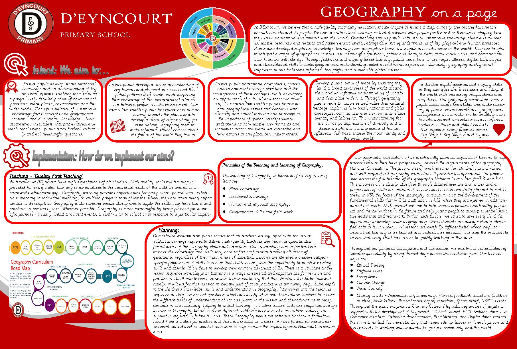
Geography at D’Eyncourt Primary
At D’Eyncourt we believe that a high-quality geography education should inspire in pupils a curiosity and fascination about the world and its people that will remain with them for the rest of their lives.
Our teaching will equip pupils with knowledge about diverse places, people, resources and natural and human environments, together with a deep understanding of the Earth’s key physical and human processes.
As pupils progress, their growing knowledge about the world should help them to deepen their understanding of the interaction between physical and human processes, and of the formation and use of landscapes and environments.
Geographical knowledge, understanding and skills provide the framework and approaches that explain how the Earth’s features at different scales are shaped, interconnected and change over time.
The national curriculum for geography aims to ensure that all pupils:
- develop contextual knowledge of the location of globally significant places both terrestrial and marine including their defining physical and human characteristics and how these provide a geographical context for understanding the actions of processes
- understand the processes that give rise to key physical and human geographical features of the world, how these are interdependent and how they bring about spatial variation and change over time
- are competent in the geographical skills needed to:
- collect, analyse and communicate with a range of data gathered through experiences of fieldwork that deepen their understanding of geographical processes
- interpret a range of sources of geographical information, including maps, diagrams, globes, aerial photographs and Geographical Information Systems (GIS)
- communicate geographical information in a variety of ways, including through maps, numerical and quantitative skills and writing at length

Key Stage 1
To develop knowledge about the world, the United Kingdom and their locality. They should understand basic subject-specific vocabulary relating to human and physical geography and begin to use geographical skills, including first-hand observation, to enhance their locational awareness.
Locational knowledge
- name and locate the world’s 7 continents and 5 oceans
- name, locate and identify characteristics of the 4 countries and capital cities of the United Kingdom and its surrounding seas
Place knowledge
- understand geographical similarities and differences through studying the human and physical geography of a small area of the United Kingdom, and of a small area in a contrasting non-European country (Dominica)
Human and physical geography
- identify seasonal and daily weather patterns in the United Kingdom and the location of hot and cold areas of the world in relation to the Equator and the North and South Poles
- use basic geographical vocabulary to refer to:
- key physical features, including: beach, cliff, coast, forest, hill, mountain, sea, ocean, river, soil, valley, vegetation, season and weather
- key human features, including: city, town, village, factory, farm, house, office, port, harbour and shop
Geographical skills and fieldwork
- use world maps, atlases and globes to identify the United Kingdom and its countries, as well as the countries, continents and oceans studied at this key stage
- use simple compass directions (north, south, east and west) and locational and directional language [for example, near and far, left and right], to describe the location of features and routes on a map
- use aerial photographs and plan perspectives to recognise landmarks and basic human and physical features; devise a simple map; and use and construct basic symbols in a key
- use simple fieldwork and observational skills to study the geography of their school and its grounds and the key human and physical features of its surrounding environmentThough the curriculum, children will be taught,
Key Stage 2
Pupils should extend their knowledge and understanding beyond the local area to include the United Kingdom and Europe, North and South America. This will include the location and characteristics of a range of the world’s most significant human and physical features. They should develop their use of geographical knowledge, understanding and skills to enhance their locational and place knowledge.
Locational knowledge
- locate the world’s countries, using maps to focus on Europe (including the location of Russia) and North and South America, concentrating on their environmental regions, key physical and human characteristics, countries, and major cities
- name and locate counties and cities of the United Kingdom, geographical regions and their identifying human and physical characteristics, key topographical features (including hills, mountains, coasts and rivers), and land-use patterns; and understand how some of these aspects have changed over time
- identify the position and significance of latitude, longitude, Equator, Northern Hemisphere, Southern Hemisphere, the Tropics of Cancer and Capricorn, Arctic and Antarctic Circle, the Prime/Greenwich Meridian and time zones (including day and night)
Place knowledge
- understand geographical similarities and differences through the study of human and physical geography of a region of the United Kingdom (The course of the River Severn), a region in a European country (Spain), and a region in North or South America (Brazil)
Human and Physical geography
- describe and understand key aspects of:
- physical geography, including: climate zones, biomes and vegetation belts, rivers, mountains, volcanoes and earthquakes, and the water cycle
- human geography, including: types of settlement and land use, economic activity including trade links, and the distribution of natural resources including energy, food, minerals and water
Geographical skills and fieldwork
- use maps, atlases, globes and digital/computer mapping to locate countries and describe features studied
- use the 8 points of a compass, 4- and 6-figure grid references, symbols and key (including the use of Ordnance Survey maps) to build their knowledge of the United Kingdom and the wider world
- use fieldwork to observe, measure record and present the human and physical features in the local area using a range of methods, including sketch maps, plans and graphs, and digital technologies
Key Vocabulary
| EYFS | Years 1 and 2 (as EYFS plus…) | Years 3 and 4 (as EYFS, Year 1 and 2 plus…) | Years 5 and 6 (as EYFS, Year 1/2/3/4 plus…) | |
| Human features | building, town, farm, road, park, path, people | city, town, village, factory, farm, house, office, port, harbour, shop, capital city, country | urban, region, Europe, county, economy, trade, energy | deforestation, derelict, economy |
| Physical features | beach, sea, lake, river, desert, mountain, hill, countryside, forest, wood, weather, seasons | beach, cliff, coast, forest, hill, mountain, sea, ocean, river, soil, valley, vegetation, season weather, marine | landscape, UK names of mountains/hills e.g. Pennines Grampians, Cambrians, Southern Uplands, North and South Downs etc. rural, climate, erosion, earthquake, volcano, water cycle, geology, minerals and rock types e.g. chalk, slate, granite, sandstone. biomes/vegetation belts e.g. tundra, coniferous, deciduous. | tributary, confluence, meander, oxbow, estuary, mouth, source, climate zones |
| Geographical map skills and fieldwork | map, local, place, globe | Asia, Africa, North America, South America, Antarctica, Australia/Oceania/Australasia, Europe, Arctic, Southern, Pacific, Atlantic, Indian, England, Scotland, Wales, Northern Ireland, Belfast, Cardiff, Edinburgh, London, North/Irish/Celtic Seas, English Channel | observe, measure/record, environmental, region, compass points: NW NE SE SW, Ordnance Survey map, scale, 4 figure grid reference, contours, symbols, minerals, rocks European country and capital city names | Geographical Information systems (GIS) Analysis of data and statistics, global warming, latitude, longitude, 6 figure grid reference, North/South hemisphere, Tropics of Capricorn and Cancer, time differences, North, Central and South American country and capital city names |
| Other useful words appropriate for phase | village, city, shop, land, house, motorway, language, world, water, pond | Environment, recycle, compass points: East, North, South, West. Fieldwork, plan, aerial photograph, map, key symbols, Equator, hot/cold, direction, key, country, continent, globe, atlas, address, right/ left, patterns, characteristics, surrounding seas | globally significant, land use, features, hemisphere, food chain, differences/similarities, compare/contrast, United Kingdom, Great Britain, condensation, evaporation, change/effect, the interaction between physical and human processes, formation, interconnected, change over time. | spatial, variation, vegetation, erosion, deposition, headland, resort, cliff, bay, delta, Geographical influences, climate change, Ordnance Survey |
| The challenge for this phase | Directional language Left/Right, near, next to, behind, Compass points -N, E, S, W | scale, route planner, grid, vegetation, urban, rural, challenge, diverse places, resources, natural and human environments | Latitude, longitude, tributary, confluence, meander, estuary, source, mouth, precipitation, Tropics of Capricorn and Cancer, terrestrial | relief, digital mapping |
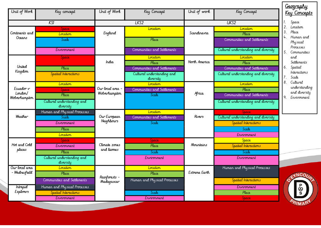
Our Geography progressive vocabulary builder identifies key vocabulary to be taught from EYFS to year 6. These words are part of our curriculum aimed at narrowing the vocabulary gap for our children. As a school, we aim to expose all children to a broad range of vocabulary and provide them with the skills to use and apply these
Knowledge Organisers
Knowledge Organisers are an excellent assessment tool that can help identify gaps in learning and inform planning, teaching, and intervention. As we have developed our own curriculum, class teachers have also developed knowledge organisers to work alongside our curriculum. Children will be encouraged to refer to knowledge organisers throughout sessions to help support and enhance their learning.

Knowledge organisers can be a valuable tool for children, staff, and parents. Class teachers are the ones who write the knowledge organiser, to set out their expectations of what pupils should learn about a topic – and to clarify their own thinking around what is important. School leaders, headteachers, and subject leaders then may look at a series of knowledge organisers to check for progression and continuity both within and across curriculum subjects and to ensure standards and expectations for learning are being implemented, and if not, what CPD is required. Pupils will review, revise and quiz themselves using their knowledge organisers. Knowledge organizers are a really clear and easy-to-understand way for parents to be more aware of what their children are learning and thus support them. Some of the benefits of knowledge organisers
- A knowledge organiser makes the teacher think hard about what will be taught.
- Knowledge organisers are an endless source of meaningful homework activities.
- Knowledge organisers are an excellent tool for inclusion.
- Knowledge organisers create opportunities for spaced retrieval practice.
- Ahead of a summative assessment at the end of a topic, you can inform pupils that some of the questions will refer to previous learning; pupils can then refer to the knowledge organiser to access and practice those topics.
- Used appropriately, knowledge organisers can increase retention of facts.
Me and My World
Download Knowledge Organiser – My World and Me
Exploring Scandinavia

Cultural Capital
According to the national curriculum, cultural capital is the ‘essential knowledge that pupils need to be educated citizens, introducing them to the best that has been thought and said and helping to engender an appreciation of human creativity and achievement.’ (Ofsted School Inspection Handbook 2019).
We are confident that Geography lessons at D’Eyncourt deliver the knowledge to enable children to function as well-informed individuals who can engage with different aspects of society and thrive in the modern world.
Our Geography curriculum starts with a study in their local area but then extends to the wider world to broaden children’s minds and appreciation of different cultures. Every year group has access to high-quality educational fieldwork visits outside of the classroom (both locally and further afield) to spark interest and excitement, ultimately increasing cultural capital. We also encourage family learning to take place during the term so that adults can experience their children’s Geography curriculum themselves and partake in the sharing of knowledge with their child.
Policies
Useful Links & Websites
https://www.rgs.org/schools/ – Royal geographical socie
https://www.geography.org.uk/ – Geographical association
https://www.kids-world-travel-guide.com/ocean-facts-for-kids.html – Kids world travel guide
